- Table View
- List View

Flags: Finland, France, Germany, Hungary (UEB Uncontracted)
by Rnib BookshareThis page shows four images: the flags of Finland, France, Germany and Hungary. There is a locator dot shown, which will be at the top left of the page when the image is the correct way up. A key at the bottom of the tactile page shows the colours used on the flags. The Finnish flag is at the top left of the page. It shows a cross on a plain background. The flag of France is in the top right corner of the page. It has three vertical stripes. The German flag is in the bottom left corner of the page. It has three horizontal stripes. The flag of Hungary is in the bottom right corner of the page. It has three horizontal stripes.
Geography (PDF)
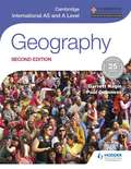
by Garrett Nagle Paul GuinnessWe are working with Cambridge International Examinations to gain endorsement for this edition for the revised 2017 syllabus. - Covers the full content of the syllabus - Written by the same renowned author team as the first edition and the bestselling Cambridge IGCSE Geography - Supports the development of geographical skills, which feature more prominently in the latest syllabus
Gcse (9-1) Geography Specification A: Geographical Themes And Challenges (PDF)
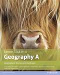
by Rob Clemens David Flint Michael Chiles John Hopkin Phillip Crossley Rob Bircher Paul GuinessExam Board: Edexcel Level: GCSE Subject: Geography (Specification A) First teaching: September 2016 First exams: Summer 2018 Series Editor: John Hopkin This Student Book: covers the essential content in the new specification with up-to-date diagrams, facts, maps and case studies of geographical events, processes and issues at work to bring the subject to life. uses the 'Thinking Geographically' approach devised by experts and targeted activities to help develop key geographical, mathematical and statistical skills in context. has 'Writing Geographically' features that focus on the writing skills most important to success in geography. This literacy support uses the proven Grammar for Writing approach used in many English departments. includes modelled fieldwork investigations and activities to support the development of enquiry skills for fieldwork studies in the specification. gives plenty of opportunities to track progress. Alongside activities throughout each topic, there are knowledge checklists, learning checkpoints, extension materials and end-of-unit tests to consolidate learning and deepen understanding. includes lots of fieldwork and exam guidance, with practice questions, sources, sample answers and tips from our experts to support preparation for GCSE assessments. *These resources have not yet been endorsed. This information is correct as of 31st July 2015, but may be subject to change. You do not have to purchase any resources to deliver our qualification.
Gcse (9-1) Geography Specification B: Investigating Geographical Issues (PDF)
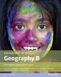
by Kevin Cooper Michael Chiles Rob Clemens David Flint John Hopkin Phillip Crossley Rob Bircher Paul GuinessGeography for all: developing confident, capable and successful geographers. Our new resources* include a Student Book for each Edexcel GCSE (9-1) Geography specification for first teaching from 2016 and more.
Geography For Cfe: Physical And Human Environments (PDF)
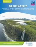
by Ian Geddes Calum CampbellWe are working with SQA to gain endorsement for this title. The only core, full colour textbook for Sections 1 and 2 of the CfE Higher Geography exam. This book is a complete guide to all components of the Physical and Human elements of the course, which make up 50% of the final external exam in Higher Geography. - Blends theoretical content and processes with detailed guidance on practical aspects - Offers regular 'What you need to know' sections, consolidation questions, reflection tasks, key words and definitions, plus Assignment links and ideas for the non-examination sections of the course Geographical and Mapping Skills are explained and illustrated throughout the text, which also provides: - exam style questions in every chapter - new, contemporary case studies and exemplars - fresh and inspirational examination of well-known geographical themes A companion volume, Higher Geography for CfE: Global Issues, provides material for Section 3 of the CfE Higher examination.
National 4 & 5 Geography: Physical Environments (PDF)
by Calvin Clarke Susan ClarkeCover every base with the complete resource for National 4 & 5 Geography endorsed by SQA! One of a three-book series, this title offers detailed, comprehensive and rigorous coverage of the physical environment elements in National 4 and 5 Geography. - Ensure understanding with end-of-chapter questions for each topic at N4 and N5 levels - Promote Active Learning through specific activites in each chapter - Engage students with a full-colour, accessible format
National 4 & 5 Geography: Global Issues (PDF)
by Calvin Clarke Susan ClarkeCover every base with the complete resource for National 4 & 5 Geography endorsed by SQA! One of a three-book series, this title offers detailed, comprehensive and rigorous coverage of four of the global issues in National 4 and 5 Geography. - Ensure understanding with end-of-chapter questions for each topic at N4 and N5 levels - Promote Active Learning through specific activites in each chapter - Engage students with a full-colour, accessible format
River Systems (Tactile)
by Adrian FarnsworthThis is a five-page document showing topographical features of rivers. Page one shows the source of a slightly meandering river, page two shows a river with tributaries, page three shows a meandering river with large loops, page four shows a lake on a river, and page five shows an estuary or river mouth.
London and Cairo Weather Graphs (Tactile)
by Adrian FarnsworthThis is a four-page document with four graphs showing weather data from London and Cairo. Page one shows rainfall in London and page two shows rainfall in Cairo. Page three shows temperature in London and page four shows temperature in Cairo.
Map of Australia showing the main cities (Tactile)
by Adrian FarnsworthThis is an outline map with braille labels showing the main cities of Australia.
Desperate Deserts (PDF)
by Anita Ganeri Mike PhillipsGeography with the gritty bits left in! Where in the world can you: Spot sand dunes that bury whole villages? Discover some deadly desert wildlife? Follow in the footsteps of daring desert explorers?

GCSE Modern World History (3rd edition) (PDF)
by Ben WalshProvide complete support for your GCSE Modern World History candidates with best-selling books and digital resources from an author you can really trust. An AQA-specific edition of the best selling textbook for GCSE Modern World History. It comprehensively covers the AQA specification and provides a winning combination that will meet the needs of all students. Clear, engaging and provocative author text which brings the period to life and summarises complicated history clearly without being simplistic. Focus Tasks which steadily deepen students' understanding of the content (exactly targeting each Key Issue of the AQA specification) while progressively building their history skills. Original and relevant source material - written and visual - all of which is used for historical investigation not just for illustration. State-of-the-art ICT support in the form of Dynamic Learning from an author who leads the field in developing the use of ICT to help refine students historical thinking. Authoritative interpretation of the AQA specification by an experienced trainer and teacher. Associated revision book in full colour. In its first and second editions this book has provided students with what they need to achieve their best; and provided teachers with what they need to teach a rewarding and worthwhile course. A winning combination - don't settle for less.
"V" shaped valley (UEB Contracted)
by RnibThis page shows four images of river valley erosion. There is a locator dot shown, which will be at the top left when the image is the correct way up. Each image is surrounded by an image border. In each image the river is shown in cross section with the water in the centre of each image. There are stones in the water. The image in the top left of the page shows vertical downwards erosion. Stones and rock particles are scraped and bounced along the channel bed. The image in the top right of the page shows the steep sides being attacked by weathering. This breaks up and loosens the soil and rock. The image in the bottom left of the page shows the loosened material creeping down the slope because of gravity and rainwater washing it down. The river then carries it away. The image in the bottom right of the page shows the final shape of the valley.
"V" shaped valley (Large Print)
by RnibThis page shows four images of river valley erosion. There is a locator dot shown, which will be at the top left when the image is the correct way up. Each image is surrounded by an image border. In each image the river is shown in cross section with the water in the centre of each image. There are stones in the water. The image in the top left of the page shows vertical downwards erosion. Stones and rock particles are scraped and bounced along the channel bed. The image in the top right of the page shows the steep sides being attacked by weathering. This breaks up and loosens the soil and rock. The image in the bottom left of the page shows the loosened material creeping down the slope because of gravity and rainwater washing it down. The river then carries it away. The image in the bottom right of the page shows the final shape of the valley.
"V" shaped valley (UEB Uncontracted)
by RnibThis page shows four images of river valley erosion. There is a locator dot shown, which will be at the top left when the image is the correct way up. Each image is surrounded by an image border. In each image the river is shown in cross section with the water in the centre of each image. There are stones in the water. The image in the top left of the page shows vertical downwards erosion. Stones and rock particles are scraped and bounced along the channel bed. The image in the top right of the page shows the steep sides being attacked by weathering. This breaks up and loosens the soil and rock. The image in the bottom left of the page shows the loosened material creeping down the slope because of gravity and rainwater washing it down. The river then carries it away. The image in the bottom right of the page shows the final shape of the valley.
Key and overview map of Europe (UEB Contracted)
by Rnib BookshareThese pages show a map of Europe with an accompanying key. It is a multi-page image set on two pages. There is a locator dot shown on each page, which will be at the top left when the image is the right way up. The image is surrounded by an image border. Key to overview map of Europe This is a list of the abbreviations and colour used on the map. The abbreviations and colour are on the left and the country names and colour meaning to the right. Overview map of Europe Europe is in the centre and right of the page. Each country is labelled. There are parts of some countries shown which are not in Europe: a southern tip of Greenland in the top left corner and the northern part of some African countries in the bottom of the page. Some of the smaller countries are not labelled because of lack of space on this overview map. A more detailed map will label all countries.
Key and map of southern Europe (UEB Contracted)
by Rnib BookshareThese pages show a map of southern Europe with an accompanying key. It is a multi-page image set on two pages. There is a locator dot shown on each page, which will be at the top left when the image is the right way up. The image is surrounded by an image border. Key to map of southern Europe This is a list of the abbreviations and colour used on the map. The abbreviations and colour are on the left and the country names and colour meaning to the right. Map of southern Europe Each country is labelled. The UK and Ireland are in the top left of the page. Not all of Scotland is shown. Mainland Europe is on the right and centre of the page. Only part of the countries along the bottom of the page are shown. They are African countries and not part of Europe.
Key and map of southern Europe (UEB Uncontracted)
by Rnib BookshareThese pages show a map of southern Europe with an accompanying key. It is a multi-page image set on two pages. There is a locator dot shown on each page, which will be at the top left when the image is the right way up. The image is surrounded by an image border. Key to map of southern Europe This is a list of the abbreviations and colour used on the map. The abbreviations and colour are on the left and the country names and colour meaning to the right. Map of southern Europe Each country is labelled. The UK and Ireland are in the top left of the page. Not all of Scotland is shown. Mainland Europe is on the right and centre of the page. Only part of the countries along the bottom of the page are shown. They are African countries and not part of Europe.
Key and map of southern Europe (Large Print)
by Rnib BookshareThese pages show a map of southern Europe with an accompanying key. It is a multi-page image set on two pages. There is a locator dot shown on each page, which will be at the top left when the image is the right way up. The image is surrounded by an image border. Key to map of southern Europe This is a list of the abbreviations and colour used on the map. The abbreviations and colour are on the left and the country names and colour meaning to the right. Map of southern Europe Each country is labelled. The UK and Ireland are in the top left of the page. Not all of Scotland is shown. Mainland Europe is on the right and centre of the page. Only part of the countries along the bottom of the page are shown. They are African countries and not part of Europe.
Key and map of northern Europe (UEB Contracted)
by Rnib BookshareThese pages show a map of northern Europe with an accompanying key. It is a multi-page image set on two pages. There is a locator dot shown on each page, which will be at the top left when the image is the right way up. The image is surrounded by an image border. Key to map of northern Europe This is a list of the abbreviations and colour used on the map. The abbreviations and colour are on the left and the country names and colour meaning to the right. Map of northern Europe Each country is labelled. The UK and Ireland are in the bottom left of the page. Iceland is in the top left of the page. Mainland Europe is on the right of the page. Only part of the countries along the bottom of the page are shown.
Key and map of northern Europe (UEB Uncontracted)
by Rnib BookshareThese pages show a map of northern Europe with an accompanying key. It is a multi-page image set on two pages. There is a locator dot shown on each page, which will be at the top left when the image is the right way up. The image is surrounded by an image border. Key to map of northern Europe This is a list of the abbreviations and colour used on the map. The abbreviations and colour are on the left and the country names and colour meaning to the right. Map of northern Europe Each country is labelled. The UK and Ireland are in the bottom left of the page. Iceland is in the top left of the page. Mainland Europe is on the right of the page. Only part of the countries along the bottom of the page are shown.
Key and map of northern Europe (Large Print)
by Rnib BookshareThese pages show a map of northern Europe with an accompanying key. It is a multi-page image set on two pages. There is a locator dot shown on each page, which will be at the top left when the image is the right way up. The image is surrounded by an image border. Key to map of northern Europe This is a list of the abbreviations and colour used on the map. The abbreviations and colour are on the left and the country names and colour meaning to the right. Map of northern Europe Each country is labelled. The UK and Ireland are in the bottom left of the page. Iceland is in the top left of the page. Mainland Europe is on the right of the page. Only part of the countries along the bottom of the page are shown.
Key and overview map of Europe (UEB Uncontracted)
by Rnib BookshareThese pages show a map of Europe with an accompanying key. It is a multi-page image set on two pages. There is a locator dot shown on each page, which will be at the top left when the image is the right way up. The image is surrounded by an image border. Key to overview map of Europe This is a list of the abbreviations and colour used on the map. The abbreviations and colour are on the left and the country names and colour meaning to the right. Overview map of Europe Europe is in the centre and right of the page. Each country is labelled. There are parts of some countries shown which are not in Europe: a southern tip of Greenland in the top left corner and the northern part of some African countries in the bottom of the page. Some of the smaller countries are not labelled because of lack of space on this overview map. A more detailed map will label all countries.
Key and overview map of Europe (Large Print)
by Rnib BookshareThese pages show a map of Europe with an accompanying key. It is a multi-page image set on two pages. There is a locator dot shown on each page, which will be at the top left when the image is the right way up. The image is surrounded by an image border. Key to overview map of Europe This is a list of the abbreviations and colour used on the map. The abbreviations and colour are on the left and the country names and colour meaning to the right. Overview map of Europe Europe is in the centre and right of the page. Each country is labelled. There are parts of some countries shown which are not in Europe: a southern tip of Greenland in the top left corner and the northern part of some African countries in the bottom of the page. Some of the smaller countries are not labelled because of lack of space on this overview map. A more detailed map will label all countries.
English Counties Map (UEB Uncontracted)
by Rnib BookshareThese pages show a map of the UK with an accompanying key. It is a multi-page image set on two pages. There is a locator dot shown on each page, which will be at the top left when the image is the right way up. Key to UK map showing the counties of England This is a list of the abbreviations and lines used on the map. There are two columns with abbreviations and lines on the left and the county names and line meaning to the right. UK map showing the counties of England England is in the centre of the page, part of Scotland is at the top and Wales is to the left of the page. Counties are labelled by abbreviations. There is a north arrow in the top right corner.