- Table View
- List View
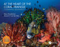
At the Heart of the Coral Triangle: Celebrating Biodiversity
by Alan J Powderham Sancia van der Meij"Endlessly fascinating, unpretentiously educational, thoughtfully accessible and beautifully presented" - Alex Tattersall, award-winning underwater photographer and the founder of Underwater Visions. The Coral Triangle, straddling the confluence of the Indian and Pacific Oceans, harbours the greatest biodiversity of marine life on the planet. It is home to a wondrous variety, including 75% of the world's coral species and around 2500 species of fish. The biological and environmental diversity is driven by the volcanically active and complex geology of the so called 'Ring of Fire'. Habitats range from underwater slopes of volcanic black sand to extensive coral reefs in atolls and vast calderas. While clearly vulnerable to increasing global threats such as climate change, pollution and overfishing, the Coral Triangle currently features some the richest coral reefs in the world. With stunning photography supported by an engaging and accessible text, this book highlights and celebrates this biodiversity along with the underlying message that it needs our care and protection before it is too late.

At the Margins of Planning: Offshore Wind Farms in the United Kingdom
by Stephen A. JayOffshore wind farms are being developed on a major scale around the UK coastline as part of the drive to increase renewable energy production. This presents a new departure for the renewables sector. Having fewer physical constraints than on land, they avoid the planning system, which currently ends at low water mark. However, planning authorities and the communities they represent are deeply concerned about the consequences of offshore wind farms along their coastal zones. This book presents an empirical investigation into the attitudes of local planning authorities into the development of offshore wind farms, examining these findings in light of wider debates about the use and management of the seas and the potential contribution of the mechanisms of planning. The book also raises questions about the geographical limits of planning and how to go about establishing a form of spatial planning to cover the marine environment.

Äthiopien — Ethiopia: Eine geographisch-medizinische Landeskunde / A Geomedical Monograph (Medizinische Länderkunde Geomedical Monograph Series #3)
by Karl F. Schaller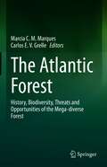
The Atlantic Forest: History, Biodiversity, Threats and Opportunities of the Mega-diverse Forest
by Marcia C. M. Marques Carlos E. V. GrelleThe Atlantic Forest is one of the 36 hotspots for biodiversity conservation worldwide. It is a unique, large biome (more than 3000 km in latitude; 2500 in longitude), marked by high biodiversity, high degree of endemic species and, at the same time, extremely threatened. Approximately 70% of the Brazilian population lives in the area of this biome, which makes the conflict between biodiversity conservation and the sustainability of the human population a relevant issue. This book aims to cover: 1) the historical characterization and geographic variation of the biome; 2) the distribution of the diversity of some relevant taxa; 3) the main threats to biodiversity, and 4) possible opportunities to ensure the biodiversity conservation, and the economic and social sustainability. Also, it is hoped that this book can be useful for those involved in the development of public policies aimed at the conservation of this important global biome.

Atlantic Reverberations: French Representations of an American Presidential Election
by Paul C. AdamsThe 2004 US election provided French citizens and their media with a springboard for re-conceiving 'self' and 'other'. Given its prominent opposition to recent US foreign policy such as the invasion of Iraq, a volley of insults and caustic remarks reverberated between France and the US. French observers linked the Bush administration's policies to particular groups and regions within the US, to a democratic deficit, to a perceived threat of US collapse and to the need for a stronger Europe. By examining how the French media - newspapers, television, the internet and scholarly research - represented the election from a critical geopolitical perspective, this book provides the first major in-depth study of views of the US in contemporary foreign media.
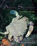
Atlantic Shorelines: Natural History and Ecology
by Mark D. BertnessA comprehensive introduction to the natural history and intertidal ecology of East Coast shorelinesAtlantic Shorelines is an introduction to the natural history and ecology of shoreline communities on the East Coast of North America. Writing for a broad audience, Mark Bertness examines how distinctive communities of plants and animals are generated on rocky shores and in salt marshes, mangroves, and soft sediment beaches on Atlantic shorelines.The book provides a comprehensive background for understanding the basic principles of intertidal ecology and the unique conditions faced by intertidal organisms. It describes the history of the Atlantic Coast, tides, and near-shore oceanographic processes that influence shoreline organisms; explains primary production in shoreline systems, intertidal food webs, and the way intertidal organisms survive; sets out the unusual reproductive challenges of living in an intertidal habitat, and the role of recruitment in shaping intertidal communities; and outlines how biological processes like competition, predation, facilitation, and ecosystem engineering generate the spatial structure of intertidal communities.The last part of the book focuses on the ecology of the three main shoreline habitats—rocky shores, soft sediment beaches, and shorelines vegetated with salt marsh plants and mangroves—and discusses in detail conservation issues associated with each of them.
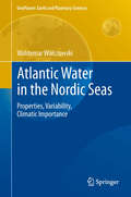
Atlantic Water in the Nordic Seas: Properties, Variability, Climatic Importance (GeoPlanet: Earth and Planetary Sciences)
by Waldemar WalczowskiThe book presents a wide description of hydrographic conditions in the studied area of the Norwegian and Greenland Seas. Variability of the Atlantic Water properties have been presented on the basis of time series obtained from oceanographic measurements performed each summer from 2000 to 2007 by the Institute of Oceanology Polish Academy of Sciences. The warming observed in that period has been described in detail as well as cooling of the Atlantic Water flowing towards the Fram Strait in 2007. Furthermore, concepts regarding multi-branch structure of the West Spitsbergen Current have been presented, types of flows in individual branches as well as variability of the flows. Description of the structure, transports and variability of the sea currents is based mostly on hydrographic measurements and baroclinic calculations. The results confirm a leading role of the ocean in climate shaping and acknowledges the importance of the Thermohaline Circulation for the climate.

Atlas and Data of Solid-Solution Equilibria of Marine Evaporites
by Eberhard Usdowski Martin F. BachSolid-solution equilibria of marine evaporites are important in a wide range of science and technology. However, the data had not yet been summarized in a form that is at the same time comprehensive and permits to understand how the quinary seawater system builds up from its bounding systems. Thus the goal of the present volume is at the same time scientific and educational. The understanding of solid-solution equilibria of the various systems with respect to dissolution, precipitation and transformation of solids, their application to the evolution of brines, and a fast access to data is a necessary requirement for any modelling, especially in Geoscience. Another goal is to show the avail ability of data. Unfortunately, though solubility data are numereous there are substantial gaps, especially with respect to high temperatures. But also up to about 100 0 C data are missing for some of the systems so that they cannot be described entirely. Based on the present volume further work on the solubili ties of the minerals of marine evaporites may be promoted. The data have been viewed and collected over several years by the first author. The second author entered the preparation of the volume when it was realized that besides graphics and tables a fast access to data was required. Although both authors are responsible for the whole volume, responsibility is weighted somewhat differently for the various parts.
Atlas and Glossary of Primary Sedimentary Structures
by F. J. Pettijohn P. E. PotterInadequate observation of sedimentary TRUSHKovA and KUKHARENKO'S "Atlas of structures has been responsible for incorrect Placer Minerals." The most comprehensive interpretation of the order of superposition atlas is the "Atlas of Textures and Struc in deformed beds and this has led, in turn, tures of Sedimentary Rocks" edited by A. to gross errors in stratigraphy and structure. V. KHABAKOV (1962). Failure to recognize and utilize those Our Atlas is an outgrowth of our work on structures which indicate direction of cur "Paleocurrents and Basin Analysis," a book rent flow has also led to incorrect, or at in which directional sedimentary structures least incomplete, understanding of basin are described and interpreted with special development. reference to the evolution of sedimentary We believe, therefore, that there is need for basins. That work, however, contains mini a work which constitutes a field guide to the mal photographic material - just enough study of these structures - a book in to give the reader some concept of the sedi which these structures, so difficult to mentary structures described.
The Atlas of Abandoned Places
by Oliver SmithThe globe is littered with forgotten monuments, their beauty matched only by the secrets of their past.A glorious palace lies abandoned by a fallen dictator. A grand monument to communism sits forgotten atop a mountain. Two never-launched space shuttles slowly crumble, left to rot in the middle of the desert. Explore these and many more of the world's lost wonders in this atlas like no other.With remarkable stories, bespoke maps and stunning photography of fifty forsaken sites, The Atlas of Abandoned Places travels the world beneath the surface; the sites with stories to tell, the ones you won't find in any guidebook.Award-winning travel writer Oliver Smith is your guide on a long-lost path, shining a light on the places that the world forgot.Locations featured in the book include:Europe: Maunsell Forts, Aldwych Station, Paris Catacombs, La Petite Ceinture, Craco, Teufelsberg, Beelitz-Heilstätten, Red Star Train Graveyard, Pyramiden, Salpa Line, Buzludzha Monument, Pripyat, Wolf's Lair, Project Riese, Sarajevo Bobsleigh Track, Albanian Bunkers, Rummu QuarryThe Americas & the Carribean: New Bedford Orpheum Theatre, City Hall Station, Bodie, The Boneyards of Western USA, Bannerman Castle, Palace of Sans Souci, Montserrat Exclusion Zone, Ciudad Perdida, Humberstone and Santa Laura, Uyuni Train Cemetery, FordlândiaThe Middle East & the Caucasus: Kayaköy, Burj Al Babas, Varosha, Tskaltubo, Palaces of SaddamAsia: Ryugyong Hotel, Buran at Baikonur, Mo'ynoq Ship Graveyard, Aniva Lighthouse, Hô' Thuy Tiên Waterpark, Fukushima Red Zone, HashimaOceania: Wittenoom, Wrecks of Homebush Bay, Port Arthur, MS World Discoverer, Second World Remains of Papua New GuineaAfrica: Shipwrecks of the Skeleton Coast, Kolmanskop, Mobutu's Gbadolite, Mos Espa, São Martinho dos Tigres

The Atlas of African Affairs
by Ieuan L.l. GriffithsThe Atlas of African Affairs is divided into five sections dealing with environmental, historical, political and economic issues and with Southern Africa. Throughout, the book presents an interdisciplinary, integrated perspective on African affairs. Most of the chapters deal with continent-wide themes and are illustrated by maps of Africa as a whole drawn to a standardised outline of the same map projection and scale. Other chapters, often by way of example, discuss parts of the continent or individual countries and are illustrated with appropriate maps. The basic format of integrated text and maps is supplemented by guides to further reading at the end of each section as well as a series of detailed statistical tables at the end of the book.
Atlas of Amazing Migrations
by Megan LeeMatt Sewell returns with a sumptuous celebration of the most amazing migrating mammals, birds, reptiles, fish, insects and even plants who battle through Earth's toughest conditions to make extreme journeys. Gorgeously illustrated in Matt's signature watercolours and described with wit and charm, animal lovers will treasure this amazing atlas.

Atlas of Antarctica: Topographic Maps from Geostatistical Analysis of Satellite Radar Altimeter Data
by Ute Christina HerzfeldThe atlas consists of 136 topographic maps derived from satellite radar altimetry (Geosat and ERS-1 data). Each map is presented together with a description of glaciologic and topographic features. The main section is preceded by an introduction and three up-to-date topics and followed by applications. Applications are in monitoring changes in Antarctic glaciers, ice streams and ice shelves, and in detailed regional studies of outlet glaciers of the inland ice. The reader will also find index maps, an exhaustive list of references on related subjects in glaciology, geodesy, geomathematics, remote sensing, and an index of the Antarctic place names.

Atlas of Bedforms in the Western Mediterranean (Springer Geography)
by Jorge Guillén Juan Acosta Francesco Latino Chiocci Albert PalanquesThis atlas illustrates the characteristics of present-day bedforms, from the shoreline to deep-sea environments, and it also includes short reviews of the main mechanisms that generate such bedforms. The atlas is aimed at the research community, in addition to students, the public at large and companies with interests in the marine environment. The book is divided into seven sections composed of a number of short chapters: 1) bedform analysis and the main physical processes, 2) bedforms in the coastal zone, 3) bedforms on prodeltas and sorted bedforms, 4) bedforms on the continental shelf, 5) bedforms and benthos, 6) bedforms in submarine canyons and 7) slope and deep-sea bedforms. This atlas offers a comprehensive, though not exhaustive, view of the diversity of bedforms and associated processes and of the morphological and temporal scales in the enclosed tideless western Mediterranean Sea.

Atlas of Benthic Foraminifera from China Seas: The Bohai Sea and the Yellow Sea (Springer Geology)
by Yanli Lei Tiegang LiThis atlas gives a comprehensive account on the benthic foraminiferal fauna in the China Seas, especially on the Bohai and the Yellow Seas. Details of about 183 species, subjected to 5 orders, 52 families and 92 genera are included. For each species there is a brief description of the morphological characteristics, synonymised names, measurements and geographical distribution worldwide, as well as a top-level elegant plate illustrated the fossil and live specimens. It could be used as a reference book for researchers working at marine biology, marine geology, micropaleontology, paleoceanography, paleobiology and related fields.
The Atlas of Birds: Diversity, Behavior, and Conservation
by Mike UnwinThe Atlas of Birds captures the breathtaking diversity of birds, and illuminates their conservation status around the world. Full-color maps show where birds are found, both by country and terrain, and reveal how an astounding variety of behavioral adaptations--from flight and feeding to nest building and song--have enabled them to thrive in virtually every habitat on Earth. Maps of individual journeys and global flyways chart the amazing phenomenon of bird migration, while bird classification is explained using maps for each order and many key families. Conservation provides a strong focus throughout, with maps illustrating where and why birds are most under threat, and what is being done to protect them. Separate sections examine key factors influencing their distribution and endangering their survival, from deforestation and climate change to invasive species and the cage-bird trade. Bird groups most affected, such as island endemics, are highlighted, while a fascinating chapter explores the complex historical relationship between birds and humans, with maps and data for everything from poultry farming to birdwatching. The maps are supported by an authoritative text that uses the very latest data and case studies from BirdLife International. Packed with sumptuous photos, original diagrams, and imaginative graphics that bring the numbers to life, this book is a stunning and timely insight into perhaps the most colorful and intriguing group of organisms on our planet. The premier illustrated atlas of bird diversity, behavior, and conservation Features full-color maps, photos, and diagrams Covers bird evolution, classification, and behavior Describes the complex relationship between birds and their habitats Explores the impact of human activities on species survival Illustrates where and why birds are most under threat--and how to protect them
The Atlas of Boston History
by Nancy S. SeasholesFew American cities possess a history as long, rich, and fascinating as Boston’s. A site of momentous national political events from the Revolutionary War through the civil rights movement, Boston has also been an influential literary and cultural capital. From ancient glaciers to landmaking schemes and modern infrastructure projects, the city’s terrain has been transformed almost constantly over the centuries. The Atlas of Boston History traces the city’s history and geography from the last ice age to the present with beautifully rendered maps. Edited by historian Nancy S. Seasholes, this landmark volume captures all aspects of Boston’s past in a series of fifty-seven stunning full-color spreads. Each section features newly created thematic maps that focus on moments and topics in that history. These maps are accompanied by hundreds of historical and contemporary illustrations and explanatory text from historians and other expert contributors. They illuminate a wide range of topics including Boston’s physical and economic development, changing demography, and social and cultural life. In lavishly produced detail, The Atlas of Boston History offers a vivid, refreshing perspective on the development of this iconic American city. Contributors Robert J. Allison, Robert Charles Anderson, John Avault, Joseph Bagley, Charles Bahne, Laurie Baise, J. L. Bell, Rebekah Bryer, Aubrey Butts, Benjamin L. Carp, Amy D. Finstein, Gerald Gamm, Richard Garver, Katherine Grandjean, Michelle Granshaw, James Green, Dean Grodzins, Karl Haglund, Ruth-Ann M. Harris, Arthur Krim, Stephanie Kruel, Kerima M. Lewis, Noam Maggor, Dane A. Morrison, James C. O’Connell, Mark Peterson, Marshall Pontrelli, Gayle Sawtelle, Nancy S. Seasholes, Reed Ueda, Lawrence J. Vale, Jim Vrabel, Sam Bass Warner, Jay Wickersham, and Susan Wilson
The Atlas of Boston History
Few American cities possess a history as long, rich, and fascinating as Boston’s. A site of momentous national political events from the Revolutionary War through the civil rights movement, Boston has also been an influential literary and cultural capital. From ancient glaciers to landmaking schemes and modern infrastructure projects, the city’s terrain has been transformed almost constantly over the centuries. The Atlas of Boston History traces the city’s history and geography from the last ice age to the present with beautifully rendered maps. Edited by historian Nancy S. Seasholes, this landmark volume captures all aspects of Boston’s past in a series of fifty-seven stunning full-color spreads. Each section features newly created thematic maps that focus on moments and topics in that history. These maps are accompanied by hundreds of historical and contemporary illustrations and explanatory text from historians and other expert contributors. They illuminate a wide range of topics including Boston’s physical and economic development, changing demography, and social and cultural life. In lavishly produced detail, The Atlas of Boston History offers a vivid, refreshing perspective on the development of this iconic American city. Contributors Robert J. Allison, Robert Charles Anderson, John Avault, Joseph Bagley, Charles Bahne, Laurie Baise, J. L. Bell, Rebekah Bryer, Aubrey Butts, Benjamin L. Carp, Amy D. Finstein, Gerald Gamm, Richard Garver, Katherine Grandjean, Michelle Granshaw, James Green, Dean Grodzins, Karl Haglund, Ruth-Ann M. Harris, Arthur Krim, Stephanie Kruel, Kerima M. Lewis, Noam Maggor, Dane A. Morrison, James C. O’Connell, Mark Peterson, Marshall Pontrelli, Gayle Sawtelle, Nancy S. Seasholes, Reed Ueda, Lawrence J. Vale, Jim Vrabel, Sam Bass Warner, Jay Wickersham, and Susan Wilson

Atlas of Challenges and Opportunities in European Neighbourhoods
by Pierre Beckouche Pierre Besnard Hugues PecoutThis atlas provides a macro-regional overview of the areas that surround the European Union, from the Sahara to the Middle East, Western Balkans to European Russia, Turkey to the Arctic. Detailing key socio-economic data as well as developmental trends, the maps provide a comprehensive territorial analysis at a local scale and explore the potential for regional integration and cooperation.These pioneering maps examine challenges that threaten this wide, yet inter-connected, region, including environmental concerns in the North, political unrest in the East, social factors in the Western Balkans, and the upheaval in the Mediterranean since the Arab spring. Coverage investigates such key countries and areas as Libya, Israel, Palestine, Syria, and the Ukraine as well as explores such essential issues as Europe’s energy procurement. In addition, it also presents a comparison with other world regions such as East Asia and North America.In the end, readers discover that territorial integration faces many shortcomings, but that deep regional cooperation would be a key driver for the EU’s sustainable future. This atlas features the main results of the “Integrated Territorial Analysis of the Neighbourhoods” research project undertaken by ESPON (The European Observation Network for Territorial Development and Cohesion). It provides scholars; local authorities and NGOs involved in cross-border cooperation; companies interested in energy, agriculture, water, transportation and communication; and interested readers with key insights into this important region.

Atlas of Changing South Africa
by A. J. ChristopherThe new edition of the atlas (first published as The Atlas of Apartheid) presents a comprehensive introduction and detailed analysis of the spatial impact of apartheid in South Africa. It covers the period of the National Party Government of 1948 to 1994, and emphasises the changes and the continuing legacy this presents to South Africans at the start of the 21st century. The Atlas makes the unique contribution of presenting the policy and its impact in visual, spatial forms by including over 70 maps, a highly appropriate method considering that apartheid was about the control of space and specific places.