- Table View
- List View
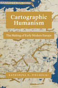
Cartographic Humanism: The Making of Early Modern Europe
by Katharina N. PiechockiPiechocki calls for an examination of the idea of Europe as a geographical concept, tracing its development in the 15th and 16th centuries. What is “Europe,” and when did it come to be? In the Renaissance, the term “Europe” circulated widely. But as Katharina N. Piechocki argues in this compelling book, the continent itself was only in the making in the fifteenth and sixteenth centuries. Cartographic Humanism sheds new light on how humanists negotiated and defined Europe’s boundaries at a momentous shift in the continent’s formation: when a new imagining of Europe was driven by the rise of cartography. As Piechocki shows, this tool of geography, philosophy, and philology was used not only to represent but, more importantly, also to shape and promote an image of Europe quite unparalleled in previous centuries. Engaging with poets, historians, and mapmakers, Piechocki resists an easy categorization of the continent, scrutinizing Europe as an unexamined category that demands a much more careful and nuanced investigation than scholars of early modernity have hitherto undertaken. Unprecedented in its geographic scope, Cartographic Humanism is the first book to chart new itineraries across Europe as it brings France, Germany, Italy, Poland, and Portugal into a lively, interdisciplinary dialogue.
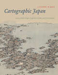
Cartographic Japan: A History in Maps
by Kären Wigen, Sugimoto Fumiko, and Cary Karacas Sugimoto Fumiko Cary KaracasMiles of shelf space in contemporary Japanese bookstores and libraries are devoted to travel guides, walking maps, and topical atlases. Young Japanese children are taught how to properly map their classrooms and schoolgrounds. Elderly retirees pore over old castle plans and village cadasters. Pioneering surveyors are featured in popular television shows, and avid collectors covet exquisite scrolls depicting sea and land routes. Today, Japanese people are zealous producers and consumers of cartography, and maps are an integral part of daily life. But this was not always the case: a thousand years ago, maps were solely a privilege of the ruling elite in Japan. Only in the past four hundred years has Japanese cartography truly taken off, and between the dawn of Japan’s cartographic explosion and today, the nation’s society and landscape have undergone major transformations. At every point, maps have documented those monumental changes. Cartographic Japan offers a rich introduction to the resulting treasure trove, with close analysis of one hundred maps from the late 1500s to the present day, each one treated as a distinctive window onto Japan’s tumultuous history. Forty-seven distinguished contributors—hailing from Japan, North America, Europe, and Australia—uncover the meanings behind a key selection of these maps, situating them in historical context and explaining how they were made, read, and used at the time. With more than one hundred gorgeous full-color illustrations, Cartographic Japan offers an enlightening tour of Japan’s magnificent cartographic archive.
Cartographic Japan: A History in Maps
by Kären Wigen Sugimoto Fumiko Cary KaracasMiles of shelf space in contemporary Japanese bookstores and libraries are devoted to travel guides, walking maps, and topical atlases. Young Japanese children are taught how to properly map their classrooms and schoolgrounds. Elderly retirees pore over old castle plans and village cadasters. Pioneering surveyors are featured in popular television shows, and avid collectors covet exquisite scrolls depicting sea and land routes. Today, Japanese people are zealous producers and consumers of cartography, and maps are an integral part of daily life. But this was not always the case: a thousand years ago, maps were solely a privilege of the ruling elite in Japan. Only in the past four hundred years has Japanese cartography truly taken off, and between the dawn of Japan’s cartographic explosion and today, the nation’s society and landscape have undergone major transformations. At every point, maps have documented those monumental changes. Cartographic Japan offers a rich introduction to the resulting treasure trove, with close analysis of one hundred maps from the late 1500s to the present day, each one treated as a distinctive window onto Japan’s tumultuous history. Forty-seven distinguished contributors—hailing from Japan, North America, Europe, and Australia—uncover the meanings behind a key selection of these maps, situating them in historical context and explaining how they were made, read, and used at the time. With more than one hundred gorgeous full-color illustrations, Cartographic Japan offers an enlightening tour of Japan’s magnificent cartographic archive.
Cartographic Japan: A History in Maps
Miles of shelf space in contemporary Japanese bookstores and libraries are devoted to travel guides, walking maps, and topical atlases. Young Japanese children are taught how to properly map their classrooms and schoolgrounds. Elderly retirees pore over old castle plans and village cadasters. Pioneering surveyors are featured in popular television shows, and avid collectors covet exquisite scrolls depicting sea and land routes. Today, Japanese people are zealous producers and consumers of cartography, and maps are an integral part of daily life. But this was not always the case: a thousand years ago, maps were solely a privilege of the ruling elite in Japan. Only in the past four hundred years has Japanese cartography truly taken off, and between the dawn of Japan’s cartographic explosion and today, the nation’s society and landscape have undergone major transformations. At every point, maps have documented those monumental changes. Cartographic Japan offers a rich introduction to the resulting treasure trove, with close analysis of one hundred maps from the late 1500s to the present day, each one treated as a distinctive window onto Japan’s tumultuous history. Forty-seven distinguished contributors—hailing from Japan, North America, Europe, and Australia—uncover the meanings behind a key selection of these maps, situating them in historical context and explaining how they were made, read, and used at the time. With more than one hundred gorgeous full-color illustrations, Cartographic Japan offers an enlightening tour of Japan’s magnificent cartographic archive.
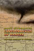
Cartographies of Danger: Mapping Hazards in America (Chicago Guides To Writing, Editing, And Publishing Ser.)
by Mark MonmonierNo place is perfectly safe, but some places are more dangerous than others. Whether we live on a floodplain or in "Tornado Alley," near a nuclear facility or in a neighborhood poorly lit at night, we all co-exist uneasily with natural and man-made hazards. As Mark Monmonier shows in this entertaining and immensely informative book, maps can tell us a lot about where we can anticipate certain hazards, but they can also be dangerously misleading. California, for example, takes earthquakes seriously, with a comprehensive program of seismic mapping, whereas Washington has been comparatively lax about earthquakes in Puget Sound. But as the Northridge earthquake in January 1994 demonstrated all too clearly to Californians, even reliable seismic-hazard maps can deceive anyone who misinterprets "known fault-lines" as the only places vulnerable to earthquakes. Important as it is to predict and prepare for catastrophic natural hazards, more subtle and persistent phenomena such as pollution and crime also pose serious dangers that we have to cope with on a daily basis. Hazard-zone maps highlight these more insidious hazards and raise awareness about them among planners, local officials, and the public. With the help of many maps illustrating examples from all corners of the United States, Monmonier demonstrates how hazard mapping reflects not just scientific understanding of hazards but also perceptions of risk and how risk can be reduced. Whether you live on a faultline or a coastline, near a toxic waste dump or an EMF-generating power line, you ignore this book's plain-language advice on geographic hazards and how to avoid them at your own peril. "No one should buy a home, rent an apartment, or even drink the local water without having read this fascinating cartographic alert on the dangers that lurk in our everyday lives. . . . Who has not asked where it is safe to live? Cartographies of Danger provides the answer."—H. J. de Blij, NBC News "Even if you're not interested in maps, you're almost certainly interested in hazards. And this book is one of the best places I've seen to learn about them in a highly entertaining and informative fashion."—John Casti, New Scientist
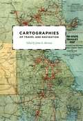
Cartographies of Travel and Navigation (The Kenneth Nebenzahl Jr. Lectures in the History of Cartography)
by James R. AkermanFinding one’s way with a map is a relatively recent phenomenon. In premodern times, maps were used, if at all, mainly for planning journeys in advance, not for guiding travelers on the road. With the exception of navigational sea charts, the use of maps by travelers only became common in the modern era; indeed, in the last two hundred years, maps have become the most ubiquitous and familiar genre of modern cartography. Examining the historical relationship between travelers, navigation, and maps, Cartographies of Travel and Navigation considers the cartographic response to the new modalities of modern travel brought about by technological and institutional developments in the twentieth century. Highlighting the ways in which the travelers, operators, and planners of modern transportation systems value maps as both navigation tools and as representatives of a radical new mobility, this collection brings the cartography of travel—by road, sea, rail, and air—to the forefront, placing maps at the center of the history of travel and movement. Richly and colorfully illustrated, Cartographies of Travel and Navigation ably fills the void in historical literature on transportation mapping.
Cartography: The Ideal and Its History
by Matthew H. EdneyOver the past four decades, the volumes published in the landmark History of Cartography series have both chronicled and encouraged scholarship about maps and mapping practices across time and space. As the current director of the project that has produced these volumes, Matthew H. Edney has a unique vantage point for understanding what “cartography” has come to mean and include. In this book Edney disavows the term cartography, rejecting the notion that maps represent an undifferentiated category of objects for study. Rather than treating maps as a single, unified group, he argues, scholars need to take a processual approach that examines specific types of maps—sea charts versus thematic maps, for example—in the context of the unique circumstances of their production, circulation, and consumption. To illuminate this bold argument, Edney chronicles precisely how the ideal of cartography that has developed in the West since 1800 has gone astray. By exposing the flaws in this ideal, his book challenges everyone who studies maps and mapping practices to reexamine their approach to the topic. The study of cartography will never be the same.
Cartography: The Ideal and Its History (The\history Of Cartography Ser. #4)
by Matthew H. EdneyOver the past four decades, the volumes published in the landmark History of Cartography series have both chronicled and encouraged scholarship about maps and mapping practices across time and space. As the current director of the project that has produced these volumes, Matthew H. Edney has a unique vantage point for understanding what “cartography” has come to mean and include. In this book Edney disavows the term cartography, rejecting the notion that maps represent an undifferentiated category of objects for study. Rather than treating maps as a single, unified group, he argues, scholars need to take a processual approach that examines specific types of maps—sea charts versus thematic maps, for example—in the context of the unique circumstances of their production, circulation, and consumption. To illuminate this bold argument, Edney chronicles precisely how the ideal of cartography that has developed in the West since 1800 has gone astray. By exposing the flaws in this ideal, his book challenges everyone who studies maps and mapping practices to reexamine their approach to the topic. The study of cartography will never be the same.
Cartography: The Ideal and Its History
by Matthew H. EdneyOver the past four decades, the volumes published in the landmark History of Cartography series have both chronicled and encouraged scholarship about maps and mapping practices across time and space. As the current director of the project that has produced these volumes, Matthew H. Edney has a unique vantage point for understanding what “cartography” has come to mean and include. In this book Edney disavows the term cartography, rejecting the notion that maps represent an undifferentiated category of objects for study. Rather than treating maps as a single, unified group, he argues, scholars need to take a processual approach that examines specific types of maps—sea charts versus thematic maps, for example—in the context of the unique circumstances of their production, circulation, and consumption. To illuminate this bold argument, Edney chronicles precisely how the ideal of cartography that has developed in the West since 1800 has gone astray. By exposing the flaws in this ideal, his book challenges everyone who studies maps and mapping practices to reexamine their approach to the topic. The study of cartography will never be the same.
Cartography: The Ideal and Its History (The\history Of Cartography Ser. #4)
by Matthew H. EdneyOver the past four decades, the volumes published in the landmark History of Cartography series have both chronicled and encouraged scholarship about maps and mapping practices across time and space. As the current director of the project that has produced these volumes, Matthew H. Edney has a unique vantage point for understanding what “cartography” has come to mean and include. In this book Edney disavows the term cartography, rejecting the notion that maps represent an undifferentiated category of objects for study. Rather than treating maps as a single, unified group, he argues, scholars need to take a processual approach that examines specific types of maps—sea charts versus thematic maps, for example—in the context of the unique circumstances of their production, circulation, and consumption. To illuminate this bold argument, Edney chronicles precisely how the ideal of cartography that has developed in the West since 1800 has gone astray. By exposing the flaws in this ideal, his book challenges everyone who studies maps and mapping practices to reexamine their approach to the topic. The study of cartography will never be the same.
Cartography: Visualization of Spatial Data
by Menno-Jan Kraak F. J. OrmelingThis revised and updated edition integrates the latest in modern technology with traditional cartographic principles. While providing a solid conceptual foundation in cartographic methodology, the text also introduces the very latest advances that have greatly influenced cartographic techniques. The new edition reflects the increasing importance of cartography as the basis for further geographical study, the text has been updated throughout and chapters on the latest developments in cartography have been integrated. There is also a more widespread emphasis on multimedia and the web.
Cartography: Visualization of Geospatial Data, Fourth Edition
by Menno-Jan Kraak Ferjan OrmelingThis fourth edition serves as an excellent introduction to general cartographic principles and as an examination of the best ways to optimize the visualization and use of spatio-temporal data. It incorporates all the changes and new developments in the world of maps such as open street maps and GPS-based crowdsourcing, the use of new web mapping technology, and adds new case studies and examples. Printed in full color, this fully-revised edition provides students with the knowledge and skills needed to read and understand maps and mapping changes, and offers professional cartographers an updated reference with the latest developments in cartography.
Cartography: Visualization of Geospatial Data, Fourth Edition
by Menno-Jan Kraak Ferjan OrmelingThis Fourth Edition of Cartography: Visualization of Geospatial Data serves as an excellent introduction to general cartographic principles. It is an examination of the best ways to optimize the visualization and use of spatiotemporal data. Fully revised, it incorporates all the changes and new developments in the world of maps, such as OpenStreetMap and GPS (Global Positioning System) based crowdsourcing, and the use of new web mapping technology and adds new case studies and examples. Now printed in colour throughout, this edition provides students with the knowledge and skills needed to read and understand maps and mapping changes and offers professional cartographers an updated reference with the latest developments in cartography. Written by the leading scholars in cartography, this work is a comprehensive resource, perfect for senior undergraduate and graduate students taking courses in GIS (geographic information system) and cartography. New in This Edition: Provides an excellent introduction to general cartographic visualization principles through full-colour figures and images Addresses significant changes in data sources, technologies and methodologies, including the movement towards more open data sources and systems for mapping Includes new case studies and new examples for illustrating current trends in mapping Provides a societal and institutional framework in which future mapmakers are likely to operate, based on UN global development sustainability goals

Cartography and Art (Lecture Notes in Geoinformation and Cartography)
by William Cartwright Georg Gartner Antje LehnThis book is the fruition of work from contributors to the Art and Cartography: Cartography and Art symposium held in Vienna in February 2008. This meeting brought together cartographers who were interested in the design and aesthetics elements of cartography and artists who use maps as the basis for their art or who incorporate place and space in their expressions. The outcome of bringing together these like minds culminated in a wonderful event, spanning three evenings and two days in the Austrian capital. Papers, exhi- tions and installations provided a forum for appreciating the endeavors of artists and cartographers and their representations of geography. As well as indulging in an expansive and expressive occasion attendees were able to re? ect on their own work and discuss similar elements in each other’s work. It also allowed cartographers and artists to discuss the potential for collaboration in future research and development. To recognise the signi? cance of this event, paper authors were invited to further develop their work and contribute chapters to this book. We believe that this book marks both a signi? cant occasion in Vienna and a starting point for future collabo- tive efforts between artists and cartographers. The editors would like to acknowledge the work of Manuela Schmidt and Felix Ortag, who undertook the task of the design and layout of the chapters.

Cartography from Pole to Pole: Selected Contributions to the XXVIth International Conference of the ICA, Dresden 2013 (Lecture Notes in Geoinformation and Cartography #8)
by Manfred Buchroithner Nikolas Prechtel Dirk BurghardtThis volume comprehends a selection of papers presented during the 26th International Cartographic Conference held in Dresden from the 26th to the 30th of August 2013. It covers many fields of relevant Mapping and GIS research subjects, such as cartographic applications, cartographic tools, generalisation and update Propagation, higher dimensional visualisation and augmented reality, planetary mapping issues, cartography and environmental modelling, user generated content and spatial data infrastructure, use and usability as well as cartography and GIS in education.

Cartography in Central and Eastern Europe: Selected Papers of the 1st ICA Symposium on Cartography for Central and Eastern Europe (Lecture Notes in Geoinformation and Cartography)
by Georg Gartner Felix OrtagThe region of Central and Eastern Europe has a rich and long history in cart- raphy. Many important improvements in mapping and cartography have been proposed and performed by cartographers and researchers of that region. The long and outstanding history has led to a lively and vivid presence. Now contemporary methods for depicting the earth and its cultural and natural attributes are used. This book focuses on the contemporary activities in all major realms of cartography in Central and Eastern Europe. It covers aspects of theoretical, topographical, thematic and multimedia cartography, which have been presented at the frst Symposium on Cartography for Central and Eastern Europe, which took place from February 16th to 17th, 2009 in Vienna, Austria and was organized by the International Cartographic Association (ICA) and the Vienna University of Technology. The symposium’s aim was to bring together cartographers, GI scientists and those working in related disciplines from CEE with the goal of offering a platform for discussion and exchange and stimulation of joined projects. About 130 scientists from 19 countries followed the invitation and visited Vienna, Austria. A selection of fully reviewed contributions is edited in this book and is meant as a mirror of the wide range of activities in the realm of cartography in this region. The innovative and contemporary character of these topics has lead to a great variety of interdis- plinary contributions. Topics cover an enormous range with heterogenous relati- ships to the main book issues.

Cartography - Maps Connecting the World: 27th International Cartographic Conference 2015 - ICC2015 (Lecture Notes in Geoinformation and Cartography)
by Claudia Robbi Sluter Carla Bernadete Madureira Cruz Paulo Márcio Leal de MenezesThis book is an important volume in the series on the state-of-art research in Cartography and GI Science. It is a collection of selected peer-reviewed papers organized into contemporary topics of research, presented at the 27th International Cartographic Conference (ICC) in Rio de Janeiro. This is the 3rd edition of selected ICA conference papers published by Springer Lectures in Geoinformation and Cartography. The conference topic is “maps connecting the world,” and Brazilian cartographers and geo-information scientists are honored to welcome their peers from all over the world to the event, which will present some of the most important recent advances in cartography research and GI science. The most relevant papers will be selected for the Springer book and these will be organized into five sections according to topic area to provide a valuable cartography and GI science reference work
The Cartoon Introduction to Climate Change
by Yoram Bauman Grady KleinClimate change is no laughing matter—but maybe it should be. The topic is so critical that everyone, from students to policy-makers to voters, needs a quick and easy guide to the basics. The Cartoon Introduction to Climate Change entertains as it educates, delivering a unique and enjoyable presentation of mind-blowing facts and critical concepts."Stand-up economist" Yoram Bauman and award-winning illustrator Grady Klein have created the funniest overview of climate science, predictions, and policy that you’ll ever read. You’ll giggle, but you’ll also learn—about everything from Milankovitch cycles to carbon taxes. If those subjects sound daunting, consider that Bauman and Klein have already written two enormously successful cartoon guides to economics, making the notoriously dismal science accessible to countless readers.If economics can be funny, then climate science can be a riot. The Cartoon Introduction to Climate Change takes the intimidation and gloom out of one of the most complex and hotly debated challenges of our time.
Cartophilia: Maps and the Search for Identity in the French-German Borderland
by Catherine Tatiana DunlopThe period between the French Revolution and World War II was a time of tremendous growth in both mapmaking and map reading throughout Europe. There is no better place to witness this rise of popular cartography than in Alsace-Lorraine, a disputed borderland that the French and Germans both claimed as their national territory. Desired for its prime geographical position and abundant natural resources, Alsace-Lorraine endured devastating wars from 1870 to 1945 that altered its borders four times, transforming its physical landscape and the political allegiances of its citizens. For the border population whose lives were turned upside down by the French-German conflict, maps became essential tools for finding a new sense of place and a new sense of identity in their changing national and regional communities. Turning to a previously undiscovered archive of popular maps, Cartophilia reveals Alsace-Lorraine’s lively world of citizen mapmakers that included linguists, ethnographers, schoolteachers, hikers, and priests. Together, this fresh group of mapmakers invented new genres of maps that framed French and German territory in original ways through experimental surveying techniques, orientations, scales, colors, and iconography. In focusing on the power of “bottom-up” maps to transform modern European identities, Cartophilia argues that the history of cartography must expand beyond the study of elite maps and shift its emphasis to the democratization of cartography in the modern world.