- Table View
- List View
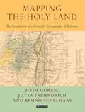
Mapping the Holy Land: The Foundation of a Scientific Cartography of Palestine (Tauris Historical Geographical Series)
by Haim Goren Jutta Faehndrich Bruno SchelhaasMapping the Holy Land provides a unique study of the cartography of the Holy Land during the formative period of its development. Through a detailed study of the work of three of the leading figures of the era - Augustus Petermann, Physical Geographer Royal to Queen Victoria; cartographer Charles Meredith van de Velde, who produced the finest map of the region at the time; and Edward Robinson, founder of modern Palestinology – the authors explore the complex cultural, cartographic and technical processes that shaped and determined the resulting maps of the region. Making full use of newly discovered archival material, and richly illustrated in both colour and black and white, Mapping the Holy Land is essential reading for cartographers, historical geographers, historians of mapmaking, and for all those with an interest in the Holy Land and the history of Palestine.
Mapping the Nation: History and Cartography in Nineteenth-Century America
by Susan SchultenIn the nineteenth century, Americans began to use maps in radically new ways. For the first time, medical men mapped diseases to understand and prevent epidemics, natural scientists mapped climate and rainfall to uncover weather patterns, educators mapped the past to foster national loyalty among students, and Northerners mapped slavery to assess the power of the South. After the Civil War, federal agencies embraced statistical and thematic mapping in order to profile the ethnic, racial, economic, moral, and physical attributes of a reunified nation. By the end of the century, Congress had authorized a national archive of maps, an explicit recognition that old maps were not relics to be discarded but unique records of the nation’s past. All of these experiments involved the realization that maps were not just illustrations of data, but visual tools that were uniquely equipped to convey complex ideas and information. In Mapping the Nation, Susan Schulten charts how maps of epidemic disease, slavery, census statistics, the environment, and the past demonstrated the analytical potential of cartography, and in the process transformed the very meaning of a map. Today, statistical and thematic maps are so ubiquitous that we take for granted that data will be arranged cartographically. Whether for urban planning, public health, marketing, or political strategy, maps have become everyday tools of social organization, governance, and economics. The world we inhabit—saturated with maps and graphic information—grew out of this sea change in spatial thought and representation in the nineteenth century, when Americans learned to see themselves and their nation in new dimensions.
Mapping Urban Practices Through Mobile Phone Data (SpringerBriefs in Applied Sciences and Technology)
by Paola Pucci Fabio Manfredini Paolo TagliolatoThis book explains the potential value of using mobile phone data to monitor urban practices and identify rhythms of use in today’s cities. Drawing upon research conducted in the Italian region of Lombardy, the authors demonstrate how maps based on mobile phone data, which are better tailored to the dynamic processes at work in cities, can document urban practices, provide new insights into spatial and temporal patterns of mobility, and assist in recognizing different communities of practice. The described methodology permits detailed visualization of the spatial distribution of mobility flows and offers a more extensive and refined description of the distribution of urban activity than is provided by traditional travel surveys. The book also details how maps derived by processing mobile phone data can assist in the definition of urban policies that will deliver services that match cities’ needs, facilitate the management of large events (inflow, outflow, and monitoring), and reflect time-dependent phenomena not included in traditional analyses.
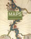
Maps: Finding Our Place in the World (Kenneth Nebenzahl, Jr., Lectures In The History Of Cartography)
by James R. Akerman Robert W. Karrow John McCarterMaps are universal forms of communication, easily understood and appreciated regardless of culture or language. This truly magisterial book introduces readers to the widest range of maps ever considered in one volume: maps from different time periods and a variety of cultures; maps made for divergent purposes and depicting a range of environments; and maps that embody the famous, the important, the beautiful, the groundbreaking, or the amusing. Built around the functions of maps—the kinds of things maps do and have done—Maps confirms the vital role of maps throughout history in commerce, art, literature, and national identity. The book begins by examining the use of maps for wayfinding, revealing that even maps as common and widely used as these are the product of historical circumstances and cultural differences. The second chapter considers maps whose makers employed the smallest of scales to envision the broadest of human stages—the world, the heavens, even the act of creation itself. The next chapter looks at maps that are, literally, at the opposite end of the scale from cosmological and world maps—maps that represent specific parts of the world and provide a close-up view of areas in which their makers lived, worked, and moved. Having shown how maps help us get around and make sense of our greater and lesser worlds, Maps then turns to the ways in which certain maps can be linked to particular events in history, exploring how they have helped Americans, for instance, to understand their past, cope with current events, and plan their national future. The fifth chapter considers maps that represent data from scientific instruments, population censuses, and historical records. These maps illustrate, for example, how diseases spread, what the ocean floor looks like, and how the weather is tracked and predicted. Next comes a turn to the imaginary, featuring maps that depict entire fictional worlds, from Hell to Utopia and from Middle Earth to the fantasy game World of Warcraft. The final chapter traces the origins of map consumption throughout history and ponders the impact of cartography on modern society. A companion volume to the most ambitious exhibition on the history of maps ever mounted in North America, Maps will challenge readers to stretch conventional thought about what constitutes a map and how many different ways we can understand graphically the environment in which we live. Collectors, historians, mapmakers and users, and anyone who has ever “gotten lost” in the lines and symbols of a map will find much to love and learn from in this book.
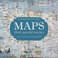
Maps: Their Untold Stories
by Rose Mitchell Andrew JanesA map is a snapshot of a place, a city, a nation or even the world at a given point in time - fascinating for what they tell us about the way our ancestors saw themselves, their neighbours and their place in the world. This magnificent collection, drawn from seven centuries of maps held in the National Archives at Kew, looks at a variety of maps, from those found in 14th Century manuscripts, through early estate maps, to sea charts, maps used in military campaigns, and maps from treaties. The text explores who the mapmakers were, the purposes for which the maps were made, and what it tells us about the politics of the time. Great images are accompanied by compelling stories. Featured is a woodcut map of 16th Century London, a map of where the bombs fell during the Second World War, and a map the first American settlers' drew when they were attempting to establish a new empire on Roanoke Island, off the coast of what is now North Carolina. Richly illustrated with large scale reproductions of the maps, the book also includes some of the more amusing or esoteric maps from the National Archives, such as the map of the Great Exhibition in 1851 that was presented on a lady's glove, a London Underground map in the form of a cucumber, and a Treasure Island map used to advertise National Savings.This is a fascinating and unusual journey through the world of maps and mapmakers.
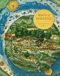
Maps of Paradise: A History Of Heaven On Earth
by Alessandro ScafiWhere is paradise? It always seems to be elsewhere, inaccessible, outside of time. Either it existed yesterday or it will return tomorrow; it may be just around the corner, on a remote island, beyond the sea. Across a wide range of cultures, paradise is located in the distant past, in a longed-for future, in remote places or within each of us. In particular, people everywhere in the world share some kind of nostalgia for an innocence experienced at the beginning of history. For two millennia, learned Christians have wondered where on earth the primal paradise could have been located. Where was the idyllic Garden of Eden that is described in the Bible? In the Far East? In equatorial Africa? In Mesopotamia? Under the sea? Where were Adam and Eve created in their unspoiled perfection? Maps of Paradise charts the diverse ways in which scholars and mapmakers from the eighth to the twenty-first century rose to the challenge of identifying the location of paradise on a map, despite the certain knowledge that it was beyond human reach. Over one hundred illustrations celebrate this history of a paradox: the mapping of the unmappable. It is also a mirror to the universal dream of perfection and happiness, and the yearning to discover heaven on earth.
Maps of Paradise
by Alessandro ScafiWhere is paradise? It always seems to be elsewhere, inaccessible, outside of time. Either it existed yesterday or it will return tomorrow; it may be just around the corner, on a remote island, beyond the sea. Across a wide range of cultures, paradise is located in the distant past, in a longed-for future, in remote places or within each of us. In particular, people everywhere in the world share some kind of nostalgia for an innocence experienced at the beginning of history. For two millennia, learned Christians have wondered where on earth the primal paradise could have been located. Where was the idyllic Garden of Eden that is described in the Bible? In the Far East? In equatorial Africa? In Mesopotamia? Under the sea? Where were Adam and Eve created in their unspoiled perfection? Maps of Paradise charts the diverse ways in which scholars and mapmakers from the eighth to the twenty-first century rose to the challenge of identifying the location of paradise on a map, despite the certain knowledge that it was beyond human reach. Over one hundred illustrations celebrate this history of a paradox: the mapping of the unmappable. It is also a mirror to the universal dream of perfection and happiness, and the yearning to discover heaven on earth.
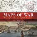
Maps of War: Mapping Conflict Through the Centuries
by Jeremy BlackThere is little documented mapping of conflict prior to the Renaissance period, but, from the 17th century onwards, military commanders and strategists began to document the wars in which they were involved and later, to use mapping to actually plan the progress of a conflict. Using contemporary maps, this sumptuous new volume covers the history of the mapping of war on land and shows the way in which maps provide a guide to the history of war. Content includes:The beginnings of military mapping up to 1600 including the impact of printing and the introduction of gunpowderThe seventeenth century: The focus is on maps to illustrate war, rather than as a planning tool and the chapter considers the particular significance of maps of fortifications.The eighteenth century: The growing need for maps on a world scale reflects the spread of European power and of transoceanic conflict between Europeans. This chapter focuses in particular on the American War of Independence.The nineteenth century: Key developments included contouring and the creation of military surveying. Subjects include the Napoleonic Wars and the American Civil WarThe twentieth century including extended features on the First and Second World Wars including maps showing trench warfare and aerial reconnaissance. Much of the chapter focuses on the period from 1945 to the present day including special sections on the Vietnam War and the Gulf Wars.
Maps with the News: The Development of American Journalistic Cartography
by Mark MonmonierMaps with the News is a lively assessment of the role of cartography in American journalism. Tracing the use of maps in American news reporting from the eighteenth century to the 1980s, Mark Monmonier explores why and how journalistic maps have achieved such importance. "A most welcome and thorough investigation of a neglected aspect of both the history of cartography and modern cartographic practice."—Mapline "A well-written, scholarly treatment of journalistic cartography. . . . It is well researched, thoroughly indexed and referenced . . . amply illustrated."—Judith A. Tyner, Imago Mundi "There is little doubt that Maps with the News should be part of the training and on the desks of all those concerned with producing maps for mass consumption, and also on the bookshelves of all journalists, graphic artists, historians of cartography, and geographic educators."—W. G. V. Balchin, Geographical Journal "A definitive work on journalistic cartography."—Virginia Chipperfield, Society of University Cartographers Bulletin
Maps with the News: The Development of American Journalistic Cartography (John D. And Catherine T. Macarthur Foundation Series On Mental Health And Development)
by Mark MonmonierMaps with the News is a lively assessment of the role of cartography in American journalism. Tracing the use of maps in American news reporting from the eighteenth century to the 1980s, Mark Monmonier explores why and how journalistic maps have achieved such importance. "A most welcome and thorough investigation of a neglected aspect of both the history of cartography and modern cartographic practice."—Mapline "A well-written, scholarly treatment of journalistic cartography. . . . It is well researched, thoroughly indexed and referenced . . . amply illustrated."—Judith A. Tyner, Imago Mundi "There is little doubt that Maps with the News should be part of the training and on the desks of all those concerned with producing maps for mass consumption, and also on the bookshelves of all journalists, graphic artists, historians of cartography, and geographic educators."—W. G. V. Balchin, Geographical Journal "A definitive work on journalistic cartography."—Virginia Chipperfield, Society of University Cartographers Bulletin
The Marathon of the Messenger: A History of Messenger RNA Vaccines
by Jérôme Lemonnier Nicolas LemonnierThe Covid-19 pandemic changed the world. Indeed a real race took place worldwide between SARS-CoV-2 on the one hand and researchers on the other – especially those specializing in messenger RNA vaccines. Four years after its emergence, the pandemic is not over, but some decisive battles have been won, thanks to the great success of mRNA vaccines. The Marathon of The Messenger presents the history of these mRNA vaccines, combining a scientific background with historical and economic perspectives. It appears that an important page in the history of these new vaccines was written in Europe, thanks to the crucial work of German and French scientists; this effort began in 1993 and continues to this day. In the face of a prevailing single-mindedness, these researchers pushed through a new therapeutic concept and defined the biotechnological keys that would open the way to the production of therapeutic messenger RNA in the fight against cancer and viral infections. Written for a broad audience and accompanied by humorous cartoons, this book will appeal to anyone looking for scientific and historical answers about mRNA vaccines. Readers will discover not only the technical and scientific knowledge of how these vaccines work, but also the economic levers that were necessary to create this technology. This book has been written in collaboration with Dr. Steve Pascolo, former director of CureVac, and the RNA messenger expert Professor Chantal Pichon. It also features a preface by Dr. Pierre Meulien, former director of the European Union public-private partnership Innovative Medicines Initiative (IMI).
Marauder (The Oregon Files #15)
by Clive Cussler Boyd MorrisonSTEP INTO THE LATEST EXPLOSIVE OREGON ADVENTURE FROM GRAND MASTER OF ADVENTURE CLIVE CUSSLERA sinister plot that will devastate the Western world.A 2,000-year-old mystery that still lurks in the depths . . .When Juan Cabrillo and the crew of the Oregon answer a distress call from a research ship, nothing can prepare them for what they find.A strange and dangerous toxin has left the crew helpless, unable to move or speak.And when another attack leaves hundreds more paralysed, Juan and his team must race to find an antidote -before the damage becomes permanent.Their search for answers leads to a Roman soldier's long-lost testimony, revealing ancient events that strangely parallel their own.But with time running out and a ruthless enemy determined to seize power at any price, it will take all of Juan's ingenuity and skill to piece together the millennia-old mystery and save the West from the point of no return . . .With explosive action, high-octane pacing and razor-sharp plotting, Marauder is the rip-roaring new adventure from Grand Master of Adventure Clive Cussler._________ PRAISE FOR CLIVE CUSSLER'Cussler is hard to beat' Daily Mail 'The Adventure King' Sunday Express'Nobody does it better... nobody!' Stephen Coonts'Just about the best storyteller in the business' New York Post
The March Up: Taking Baghdad With The 1st Marine Division
by Bing West Ray SmithTaking us straight to the front lines, The March Up follows the famed 1st Marine Division on their decisive 1,184 kilometre trek to Baghdad, from first assault to the taking of the city. The 1st Marine Division, which had fought in Guadalcanal, Khe San, and Kuwait City, provided the critical force in Operation Iraqi Freedom. With unprecedented access to everyone from three-star generals to privates, authors West and Smith, men with 60 years of military and combat experience between them, trace the strategic war plans as they unfolded in battle, providing unflinching portrayals of what went well and what went poorly, and detailing power struggles and failures which have never before been reported. No other journalist had the mobility, battlefield knowledge or personal contacts as West or Smith. They were able to observe eighteen separate combat units in the division. What emerges is a dramatic, personal and human account of how the corporals fought and the generals plotted, revealing the men behind the guns and the brave and sometimes unorthodox actions that resulted in astonishing triumphs. Complete with a 16- page, four-colour photo insert and endpaper maps, The March Up is the behind-the-scenes story of how the men on the frontlines and the strategists in the backroom turned the march to Baghdad into a road to victory.