- Table View
- List View
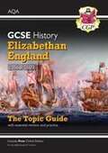
Grade 9-1 GCSE History AQA Topic Guide - Elizabethan England, c1568-1603
by Cgp BooksFor AQA 9-1 GCSE History exam success, don't miss CGP's fantastic Topic Guide covering Elizabethan England (c1568-1603). It's packed with crystal-clear revision notes, heaps of activities, interpretations and exam-style questions (with answers) - perfect for helping students test their understanding of the topic and master the skills they'll need for the exam. Our handy worked answers and exam advice mean students can walk into the exam feeling confident that they're fully prepared.
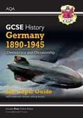
Grade 9-1 GCSE History AQA Topic Guide - Germany, 1890-1945: Democracy and Dictatorship (PDF)
by Cgp BooksCGP's superb Topic Guide for AQA 9-1 GCSE History – Germany (1890-1945): Democracy and Dictatorship has everything students need for exam success. It's packed with crystal-clear revision notes, heaps of activities, interpretations and exam-style questions (with answers) - perfect for helping students test their understanding of the topic and master the skills they'll need for the exam. Our handy worked answers and exam advice mean students can walk into the exam feeling confident that they're fully prepared. For copyright reasons, this book is not for sale outside of the UK.
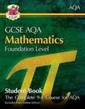
Grade 9-1 GCSE Maths AQA Student Book - Foundation (with Online Edition)
by Cgp Books"For success in AQA 9-1 GCSE Foundation Maths, look no further than CGP's in-depth Student Book. It’s packed with detailed, accessible notes, backed up with fully worked examples. Practice questions and exam-style questions are included throughout, complete with worked solutions. Each section is rounded off with a review exercise - perfect for students to recap all of the content they've learnt. We’ve even included handy references to the AQA specification and learning objectives so they know exactly which bits of the spec are covered by each part of the book. A free Online Edition of the whole book is also included - just use the unique code printed inside the front cover to access it on a PC, Mac or tablet! "
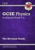
Grade 9-1 GCSE Physics: Edexcel Revision Guide with Online Edition
by Cgp BooksThis fantastic CGP Revision Guide is perfectly matched to the Higher Level Grade 9-1 Edexcel GCSE Physics course. Every topic is explained with clear, succinct study notes, examples and diagrams - and there are practice questions at the end of every page to test you on what you’ve learned (with answers and mark schemes included). We’ve covered all the crucial new elements of the Grade 9-1 course, including the required practicals, maths skills and Working Scientifically. What’s more, a free Online Edition of the whole book is included - just use the unique access code printed inside the cover to access it on a PC, Mac or tablet! And to make sure you’re 100% prepared for the final exams, a matching Physics Exam Practice Workbook is also available from CGP - see 9781782944973.
Grade 9-1 GCSE Physics: OCR 21st Century Exam Practice Workbook (PDF)
by Cgp BooksThis superb Exam Practice Workbook is the perfect way to prepare for the Higher Level OCR 21st Century GCSE Physics exams. It’s packed with a wide range of realistic exam-style questions for every topic, including coverage of Working Scientifically and all the Required Practical Activities. Every question is labelled with a grade range on the 9-1 scale, so it’s easy for students to focus their practice on the difficulty level that suits them best. Detailed step-by-step answers are available in a separate book (P2QA41). Matching study notes for OCR 21st Century GCSE Physics are available in CGP’s brilliantly clear Revision Guide.
Grade 9-1 GCSE Religious Studies: AQA A Complete Revision & Practice with Online Edition
by Cgp BooksThis chunky CGP Complete Revision & Practice book is a fantastic guide to the Grade 9-1 GCSE AQA A Religious Studies course. It’s full to the brim with straightforward study notes covering all the theory needed for Christianity, Catholic Christianity, Islam, Judaism and Themes A-H. There are exam-style questions on every topic, plus a full practice paper (including answers) to ensure students have got to grips with everything they need to know. And if that wasn’t enough, we’ve thrown in exam advice and guidance on spelling, punctuation and grammar to make sure every base is covered! There’s also a free Online Edition of the whole book - just use the code printed inside the cover to access it on your PC, Mac or tablet.
Grade 9-1 GCSE Spanish Translation Skills Workbook (includes Answers) (PDF)
by Cgp BooksWhen it comes to Grade 9-1 GCSE Spanish exam prep, this superb Translation Workbook is perfect for helping students build their skills — and it’s suitable for AQA, Edexcel and WJEC Eduqas. It covers all the key topics and is packed with translation passages both from English and to English! There are plenty of exercises to gradually build up students’ skills and exam-style questions to test their knowledge (with answers at the back).

Grade 9-4 AQA Level 2 Certificate: Further Maths - Revision Guide (with Online Edition)
by Richard ParsonsThere’s no better way to prepare for the Grade 9-4 AQA Level 2 Certificate in Further Maths than with this fantastic CGP Revision Guide! It’s packed with crystal-clear study notes and plenty of worked examples to demonstrate how each method works. There are also exam-style practice questions throughout, plus revision summary questions at the end of each section to put students’ knowledge to the test. What’s more, a free Online Edition of the whole book is included - just use the unique code in the printed book to access it on a PC, Mac or tablet. For even more practice, don’t miss CGP’s matching Further Maths Exam Practice Workbook (9781789082418).
Graduated Assessment: OCR GCSE Mathematics Stage 6 (GCSE Mathematics for OCR Modular Two Tier GCSE) (PDF)
by Michael Hanbury Jean Matthews John Jeskins Brian Seager Michael BaxterEach text book in this series provides complete coverage of one or two of the ten stages that make up the Graduated Assessment specification. Students use the combination of stages best suited to their needs and abilities.

Graduated Assessment: OCR GCSE Mathematics Stages 3 and 4 (2nd edition) (PDF)
by Jean Matthews John Jeskins Michael Handbury Brian Seager Mark Patmore Howard BaxterContents Multiplying and dividing Time Squares and square roots Formulae Working with measures Fractions Probability Using graphs Equations Mean and range Percentages Three-dimensional shapes Collecting and illustrating data Order of operations Scale drawings Enlargement

Graduated Assessment for OCR GCSE Mathematics: Stage 8 (PDF)
by Jean Matthews John Jeskins Michael Handbury Mark Patmore Howard BaxterEach text book in this series provides complete coverage of one or two of the ten stages that make up the Graduated Assessment specification. Students use the combination of stages best suited to their needs and abilities. Contents include: Fractions Graphs Probability Equations Percentages Transformations Trigonometry Quadratics Formulae nbsp;
Graphic Product: Revision Workbook (PDF)
by Debbie EasonThe student-friendly, uncluttered approach to GCSE revision, guides students through the core content with succinct revision notes and practice questions that focus on the essential content needed for the exams.
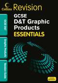
Graphic Products: Revision Guide (PDF)
by Debbie EasonThe student-friendly, uncluttered approach to GCSE revision, guides students through the core D and T content with succinct revision notes and practice questions that focus on the essential content needed for the exams. Short sentences, focused paragraphs and bullet points help to make the content accessible to students of all abilities.
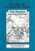
Graphic Shakespeare Series: The Tempest (Abridged edition) (PDF)
by William ShakespeareDesigned for students with special educational needs, and for those with English as a second languge, this text gives a simplified retelling of the play in accessible yet vivid language. Strong illustrations bring the play to life. Readership age: 11 to 16.
Great Britain and Ireland annual precipitation (Large Print)
This is a multi-page image of annual precipitation in Great Britain and Ireland, set on two pages. There are locator dots shown, which will be at the top left of each page when the images are the right way up. Great Britain and Ireland map: This page shows a map of Great Britain and Ireland only. It has a dashed line image border and a north arrow. The map of Great Britain and Ireland is in the middle of the page and extends to the top and bottom of the page. Mainland Great Britain is to the right and separated from Ireland by the Irish Sea. The north arrow is in the top right corner of the page and is framed by an image border. Great Britain and Ireland annual precipitation: This page shows a map of Great Britain and Ireland indicating rainfall in different areas. It has a key, a north arrow and a dashed line image border. The key is at the top left of the page. On the left, it shows examples of the textures (colours) used to indicate levels of rainfall, on the map, with descriptive labels to the right. The key is framed by an image border. Britain and Ireland are in the centre of the page and extend to the top and bottom of the page with mainland Britain on the right and Ireland on the left. In the top right corner of the diagram the north arrow is framed by an image border.
Great Britain and Ireland annual precipitation (UEB Contracted)
This is a multi-page image of annual precipitation in Great Britain and Ireland, set on two pages. There are locator dots shown, which will be at the top left of each page when the images are the right way up. Great Britain and Ireland map: This page shows a map of Great Britain and Ireland only. It has a dashed line image border and a north arrow. The map of Great Britain and Ireland is in the middle of the page and extends to the top and bottom of the page. Mainland Great Britain is to the right and separated from Ireland by the Irish Sea. The north arrow is in the top right corner of the page and is framed by an image border. Great Britain and Ireland annual precipitation: This page shows a map of Great Britain and Ireland indicating rainfall in different areas. It has a key, a north arrow and a dashed line image border. The key is at the top left of the page. On the left, it shows examples of the textures (colours) used to indicate levels of rainfall, on the map, with descriptive labels to the right. The key is framed by an image border. Britain and Ireland are in the centre of the page and extend to the top and bottom of the page with mainland Britain on the right and Ireland on the left. In the top right corner of the diagram the north arrow is framed by an image border.
Great Britain and Ireland annual precipitation (UEB Uncontracted)
This is a multi-page image of annual precipitation in Great Britain and Ireland, set on two pages. There are locator dots shown, which will be at the top left of each page when the images are the right way up. Great Britain and Ireland map: This page shows a map of Great Britain and Ireland only. It has a dashed line image border and a north arrow. The map of Great Britain and Ireland is in the middle of the page and extends to the top and bottom of the page. Mainland Great Britain is to the right and separated from Ireland by the Irish Sea. The north arrow is in the top right corner of the page and is framed by an image border. Great Britain and Ireland annual precipitation: This page shows a map of Great Britain and Ireland indicating rainfall in different areas. It has a key, a north arrow and a dashed line image border. The key is at the top left of the page. On the left, it shows examples of the textures (colours) used to indicate levels of rainfall, on the map, with descriptive labels to the right. The key is framed by an image border. Britain and Ireland are in the centre of the page and extend to the top and bottom of the page with mainland Britain on the right and Ireland on the left. In the top right corner of the diagram the north arrow is framed by an image border.
Great Britain and Ireland January temperatures (Large Print)
This is a multi-page image of Great Britain and Ireland January temperatures, set on two pages. There are locator dots shown, which will be at the top left of each page when the images are the right way up.Great Britain and Ireland map: This page shows a map of Britain and, Ireland. It has a dashed line image border and a north arrow. The map of Britain and, Ireland is in the middle of the page and extends to the top and bottom of the page. Mainland Great Britain is to the right and separated from Ireland by the Irish Sea. The north arrow is in the top right corner of the page and is framed by an image border. Great Britain and Ireland January temperatures: This is a map of Britain and, Ireland with a dashed line image border and a north arrow. Great Britain and Ireland are in the centre of the page extending to the top and bottom. Ireland is on the left and Great Britain on the right separated by the Irish Sea. There are five heavy dashed lines representing isotherms (lines of equal temperature) shown on the map. These run approximately north to south, although one of these, in the centre of Ireland, is a closed loop. The temperature labels are to be found to the bottom and to the right of the land mass. In the top right corner is a north arrow enclosed by a dashed line image border.
Great Britain and Ireland January temperatures (UEB Contracted)
This is a multi-page image of Great Britain and Ireland January temperatures, set on two pages. There are locator dots shown, which will be at the top left of each page when the images are the right way up.Great Britain and Ireland map: This page shows a map of Britain and, Ireland. It has a dashed line image border and a north arrow. The map of Britain and, Ireland is in the middle of the page and extends to the top and bottom of the page. Mainland Great Britain is to the right and separated from Ireland by the Irish Sea. The north arrow is in the top right corner of the page and is framed by an image border. Great Britain and Ireland January temperatures: This is a map of Britain and, Ireland with a dashed line image border and a north arrow. Great Britain and Ireland are in the centre of the page extending to the top and bottom. Ireland is on the left and Great Britain on the right separated by the Irish Sea. There are five heavy dashed lines representing isotherms (lines of equal temperature) shown on the map. These run approximately north to south, although one of these, in the centre of Ireland, is a closed loop. The temperature labels are to be found to the bottom and to the right of the land mass. In the top right corner is a north arrow enclosed by a dashed line image border.
Great Britain and Ireland January temperatures (UEB Uncontracted)
This is a multi-page image of Great Britain and Ireland January temperatures, set on two pages. There are locator dots shown, which will be at the top left of each page when the images are the right way up.Great Britain and Ireland map: This page shows a map of Britain and, Ireland. It has a dashed line image border and a north arrow. The map of Britain and, Ireland is in the middle of the page and extends to the top and bottom of the page. Mainland Great Britain is to the right and separated from Ireland by the Irish Sea. The north arrow is in the top right corner of the page and is framed by an image border. Great Britain and Ireland January temperatures: This is a map of Britain and, Ireland with a dashed line image border and a north arrow. Great Britain and Ireland are in the centre of the page extending to the top and bottom. Ireland is on the left and Great Britain on the right separated by the Irish Sea. There are five heavy dashed lines representing isotherms (lines of equal temperature) shown on the map. These run approximately north to south, although one of these, in the centre of Ireland, is a closed loop. The temperature labels are to be found to the bottom and to the right of the land mass. In the top right corner is a north arrow enclosed by a dashed line image border.
Great Britain and Ireland July temperatures (Large Print)
This is a multi-page image of Great Britain and Ireland July temperatures, set on two pages. There are locator dots shown, which will be at the top left of each page when the images are the right way up. Great Britain and Ireland map: This page shows a map of Great Britain and Ireland. It has a dashed line image border and a north arrow. The map is in the middle of the page and extends to the top and bottom of the page. Mainland Great Britain is to the right and separated from Ireland by the Irish Sea. The north arrow is in the top right corner of the page and is framed by an image border. Great Britain and Ireland July temperatures: This is a map of Great Britain and Ireland with a dashed line image border and a north arrow. Great Britain and Ireland are in the centre of the page extending to the top and bottom. Ireland is on the left and Britain on the right separated by the Irish Sea. There are six heavy dashed lines representing isotherms (lines of equal temperature) shown on the map. Most of these run from east to west, although two of the lines form closed loops; these are indicated by labels on the right. In the top right corner is a north arrow enclosed by a dashed line image border.
Great Britain and Ireland July temperatures (UEB Contracted)
This is a multi-page image of Great Britain and Ireland July temperatures, set on two pages. There are locator dots shown, which will be at the top left of each page when the images are the right way up. Great Britain and Ireland map: This page shows a map of Great Britain and Ireland. It has a dashed line image border and a north arrow. The map is in the middle of the page and extends to the top and bottom of the page. Mainland Great Britain is to the right and separated from Ireland by the Irish Sea. The north arrow is in the top right corner of the page and is framed by an image border. Great Britain and Ireland July temperatures: This is a map of Great Britain and Ireland with a dashed line image border and a north arrow. Great Britain and Ireland are in the centre of the page extending to the top and bottom. Ireland is on the left and Britain on the right separated by the Irish Sea. There are six heavy dashed lines representing isotherms (lines of equal temperature) shown on the map. Most of these run from east to west, although two of the lines form closed loops; these are indicated by labels on the right. In the top right corner is a north arrow enclosed by a dashed line image border.